


Artículo: AMZ-B0G2JFMFFC
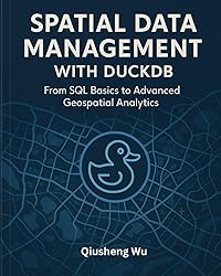
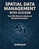
Spatial Data Management with DuckDB: From SQL Basics to Advanced Geospatial Analytics
Format:
Paperback
Detalles del producto
Disponibilidad
En stock
En stock
Peso con empaque
1.16 kg
1.16 kg
Devolución
Sí
Sí
Condición
Nuevo
Nuevo
Producto de
Amazon
Amazon
Viaja desde
USA
USA
Sobre este producto
- Master modern spatial data management with DuckDB, the fast and efficient analytical database that's transforming how GIS professionals work with geospatial data. This comprehensive guide takes you from fundamental SQL concepts to advanced geospatial analytics, with hands-on examples using real-world datasets including the US National Wetlands Inventory, Overture global building footprints, and NYC taxi data.Discover how DuckDB's spatial extension and GDAL integration enable you to process massive geospatial datasets with unprecedented speed and efficiency. Through 14 practical chapters filled with working code examples and step-by-step tutorials, you'll learn to handle Shapefiles, GeoJSON, GeoParquet, and cloud-native formats like PMTiles, while building interactive maps and dashboards that bring your data to life.Who This Book Is For:This book is designed for GIS analysts, data scientists, and spatial developers who want to leverage DuckDB for their geospatial workflows. Whether you're transitioning from traditional GIS tools, looking to handle larger datasets more efficiently, or seeking to integrate spatial analysis into modern data pipelines, this book provides the practical guidance you need. A basic understanding of spatial concepts is helpful, but no prior DuckDB or SQL experience is required.What You Will Learn:Install and configure DuckDB with the spatial extensionWrite and optimize SQL queries for spatial data operationsIntegrate DuckDB with Python, Pandas, and PolarsImport and export geospatial formats: Shapefile, GeoJSON, GeoParquet, PMTilesPerform geometry operations, projections, and measurementsRun spatial joins, point-in-polygon, and nearest-neighbor queriesVisualize data interactively using Leafmap and Jupyter NotebooksAnalyze large-scale cloud-native datasets using PMTilesWork with case studies on wetlands, buildings, and mobility dataBuild dynamic dashboards with SolaraOptimize performance for large-scale geospatial processingLeverage GDAL for advanced format support and conversionsKey Features:Hands-on, example-driven approach with fully working codeChapter-end exercises to reinforce learningReal-world datasets and case studies throughoutSeamless Python ecosystem integration (Leafmap, Pandas, GeoPandas)Comprehensive coverage of DuckDB 1.4.x spatial featuresClear, step-by-step workflows for production-ready analyticsExpert troubleshooting tips and performance tuning insightsBy the end of this book, you'll be able to confidently use DuckDB for your spatial data management and analysis workflows, processing datasets of any size, performing complex spatial analysis with ease, and building interactive, high-performance applications that reveal deep geospatial insights.
$130,68
44% OFF
$72,60
IMPORT EASILY
By purchasing this product you can deduct VAT with your RUT number
$130,68
44% OFF
$72,60
Envío gratis
Con envío
Este producto viaja
de USA ![]() a tus manos en
a tus manos en
![]()
Compra protegida
Disfruta de una experiencia de compra segura y confiable
![]() Garantía de entrega
Garantía de entrega
Con Tiendamia todas tus compras cuentan con Garantía de Entrega o devolución total de tu dinero.
Compras 100% seguras y garantizadas, para que pidas lo que sueñas y lo recibas del mundo a tu puerta.
Tarjetas de Débito y Crédito
Visa
Mastercard
American Express
Dinners
Discover
Alias
Pagos a través de PayPal
Compra procesada en dólares con dinero en cuenta o tarjetas internacionales.
PayPal

.svg)
